Insights

Climate Risk Analysis is the process used to identify, analyse and quantify the impacts of climate change on activities, assets, infrastructure and networks.
By integrating climate and geospatial data with operational information, it turns risk into useful insights to support decision-making, protect business continuity and plan adaptation measures.
When risk is interpreted within the context in which people, assets and territories operate, it becomes a guide for making more informed decisions.
In this article, we will explore:
Climate Risk Analysis assesses how climate events may affect the functioning of organisations, infrastructure and production systems. The objective is to estimate potential impacts in order to identify intervention priorities and support more effective decisions.
The analysis considers two categories of risk.
Physical risks, which are central to the management of assets and infrastructure, include:
These phenomena can compromise business continuity, safety, performance and management costs. Here are some practical examples:
Physical risks are accompanied by transition risks, linked to regulatory, technological and market developments, which can affect asset value and corporate strategies.
Understanding where risk can disrupt the functioning of a system is the first step towards building tangible resilience.
An effective Climate Risk Analysis begins with the integration of data from different sources. Historical climate data makes it possible to analyse observed events, while forward-looking climate scenarios make it possible to estimate how they may evolve over different time horizons.
This information is integrated with geospatial and territorial data, such as satellite imagery, digital terrain models, maps and territorial characteristics, together with asset-specific information, including location, technical characteristics, maintenance status and operational criticalities.
The analysis connects four fundamental elements.
| Component | Meaning |
|---|---|
| Climate hazard (Hazard) | Probability and intensity of the climate phenomenon. |
| Exposure | Presence of assets in the affected areas. |
| Vulnerability | Sensitivity of the asset and its ability to withstand the event. |
| Potential impact (Impact) | Physical, operational and economic consequences resulting from the interaction between the three previous components. |
The value of data does not depend on its quantity, but on the ability to turn it into decisions that make infrastructure and territories more resilient.
The quality of Climate Risk Analysis depends on the ability to integrate climate data with organisation-specific information, turning it into a risk assessment that is genuinely useful for defining intervention priorities and adaptation strategies.
Discover how Airis integrates these elements into a single model and provides a measurable impact for each asset.
A Climate Risk Analysis follows a structured process that turns climate and geospatial data into useful information for assessing risk and defining intervention priorities.
The first phase consists of defining the scope of the assessment by identifying:
The scope may include a substation exposed to flood risk, a section of railway track subject to deformation on days of extreme heat, or a road tunnel located on an unstable slope.
The time horizons and climate scenarios most consistent with the organisation’s objectives are also established.
For each element, the following are analysed:
This phase makes it possible to understand where risk may produce the most significant impacts.
The final phase consists of estimating:
Risks are then classified according to their relevance and transformed into:
In this way, the analysis supports intervention planning and resource allocation.
Analysing a single asset requires a different approach from analysing infrastructure distributed across a territory.
A linear network cannot be assessed as the simple sum of independent points. It is necessary to consider:
Protecting a network means understanding how risk propagates through its connections, not only where it occurs.
Airis analyses these dynamics at the level of both individual assets and extended networks, identifying the most exposed sections.
This approach is particularly useful for:
It is also applicable to telecommunications and other distributed infrastructure, making it possible to compare numerous network segments, identify the most exposed ones and define intervention priorities.
Climate Risk Analysis supports reporting, governance and strategic planning by helping organisations assess the financial impacts that climate change may have on assets, infrastructure and business continuity.
It also contributes to the assessment of double materiality by considering:
The information produced supports CSRD requirements and TCFD recommendations, integrating climate risk into decision-making processes without being limited to regulatory compliance alone.
The results of Climate Risk Analysis make it possible to:
The analysis should be updated periodically to incorporate new climate data, forward-looking scenarios and changes to assets.
Climate data creates value when it is turned into operational decisions that increase the resilience of assets, infrastructure and territories.
With Airis, Eoliann provides a platform that integrates climate data, geospatial information and asset characteristics into a single analysis environment.
Thanks to high-resolution risk models, it makes it possible to assess the evolution of physical risks under different climate scenarios and identify the areas that require priority intervention.
The platform supports organisations and infrastructure operators in:
Discover how to turn climate risk into operational decisions.
The two terms are often used interchangeably. In general, Climate Risk Analysis focuses more on data processing and quantification, while Climate Risk Assessment covers the entire risk assessment process.
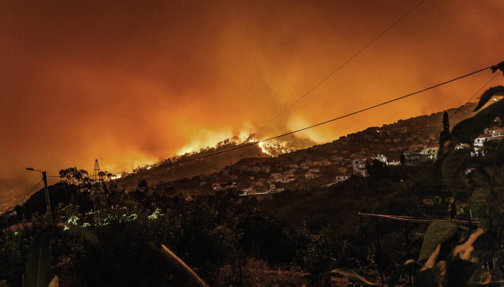
The main risks include physical risks and transition risks. Physical risks include floods, wildfires, wind gusts, landslides, extreme rainfall, drought, falling trees and heatwaves.
A Climate Risk Analysis integrates historical and forward-looking climate data, climate scenarios, geospatial data, satellite imagery and asset-specific information.
The analysis considers the geographical continuity of the network, critical nodes, the most vulnerable sections, interdependencies between assets and potential cascading effects.
It supports the assessment of climate-related financial risks, sustainability reporting and strategic planning, while also contributing to double materiality analysis.
The analysis should be updated periodically and whenever climate data, scenarios, assets or the operational scope change.
Discover related content.
Want to go deeper?